


les maîtres du mont

MarcVachet
User
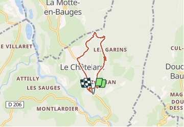

Length
5.1 km

Max alt
1032 m

Uphill gradient
296 m
Km-Effort
9 km

Min alt
739 m

Downhill gradient
295 m
Boucle
Yes
Creation date :
2020-05-22 08:12:14.704
Updated on :
2020-05-22 11:48:42.352
2h44
Difficulty : Easy

FREE GPS app for hiking
 SityTrail
IGN / Geographical institutes
SityTrail Plus
The world is yours!
About
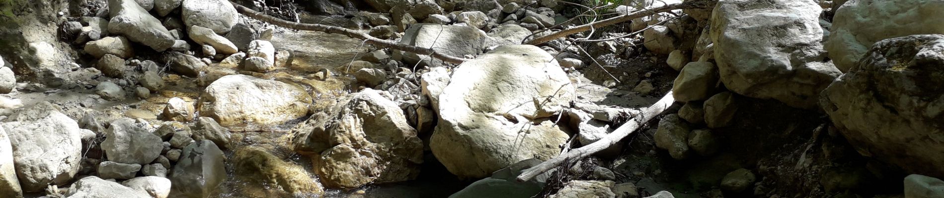
Trail Walking of 5.1 km to be discovered at Auvergne-Rhône-Alpes, Savoy, Le Châtelard. This trail is proposed by MarcVachet.
Photos

Positioning
Country:
France
Region :
Auvergne-Rhône-Alpes
Department/Province :
Savoy
Municipality :
Le Châtelard
Location:
Unknown
Start:(Dec)
Start:(UTM)
277226 ; 5062547 (32T) N.
Comments